


In a rare local example of thoughtful re-purposing, what had been a 35-acre hole excavated for I-40 fill sand has become the centerpiece of a 92-acre county park, complete with playground, picnic shelter, dock, and a paved loop trail.
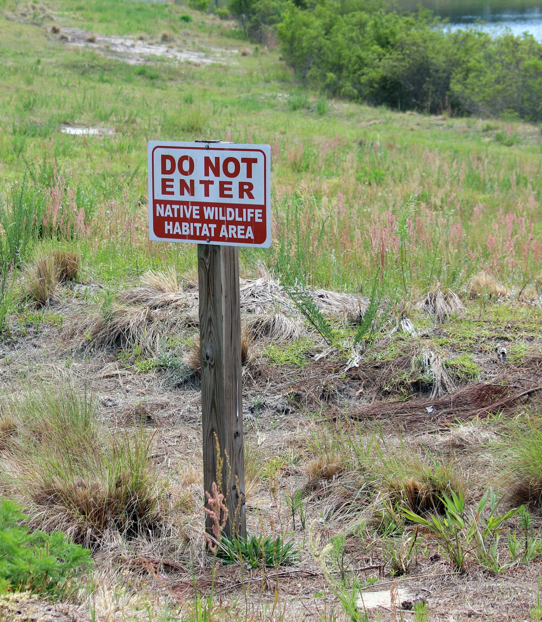
While we have never seen anyone actually paddling around the ‘lake’, its steep banks are threaded with trails people have made to get to the water’s edge for fishing. (despite the ‘Warning, Alligators’ signage…) The shore vegetation is a mix of planted and opportunistic mostly native species, which are allowed to grow and flower. It’s refreshing to see these sorts of signs. This restricted mowing regime is INTENTIONAL, y’all!

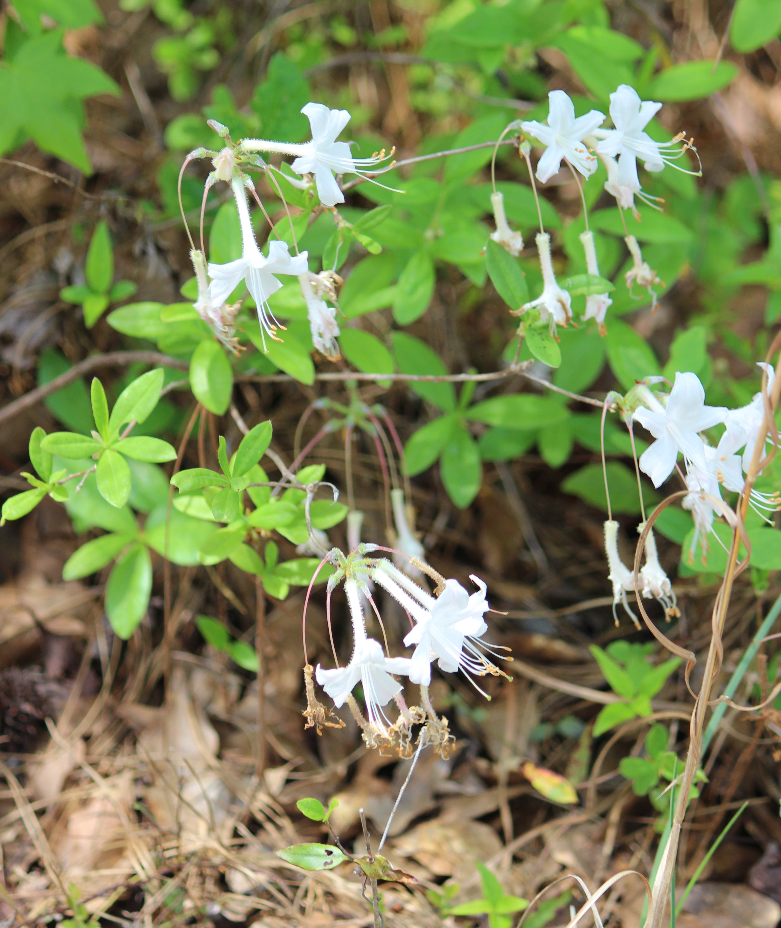
Our wandering habits always take us off-trail and into the woods, so we explored the wider perimeter of the park, beyond the west boundary. The outer edge , at least along it’s north and west boundaries , still has a great mix of native vegetation – with some relics of pocosin as well as more mesic sandy woods.

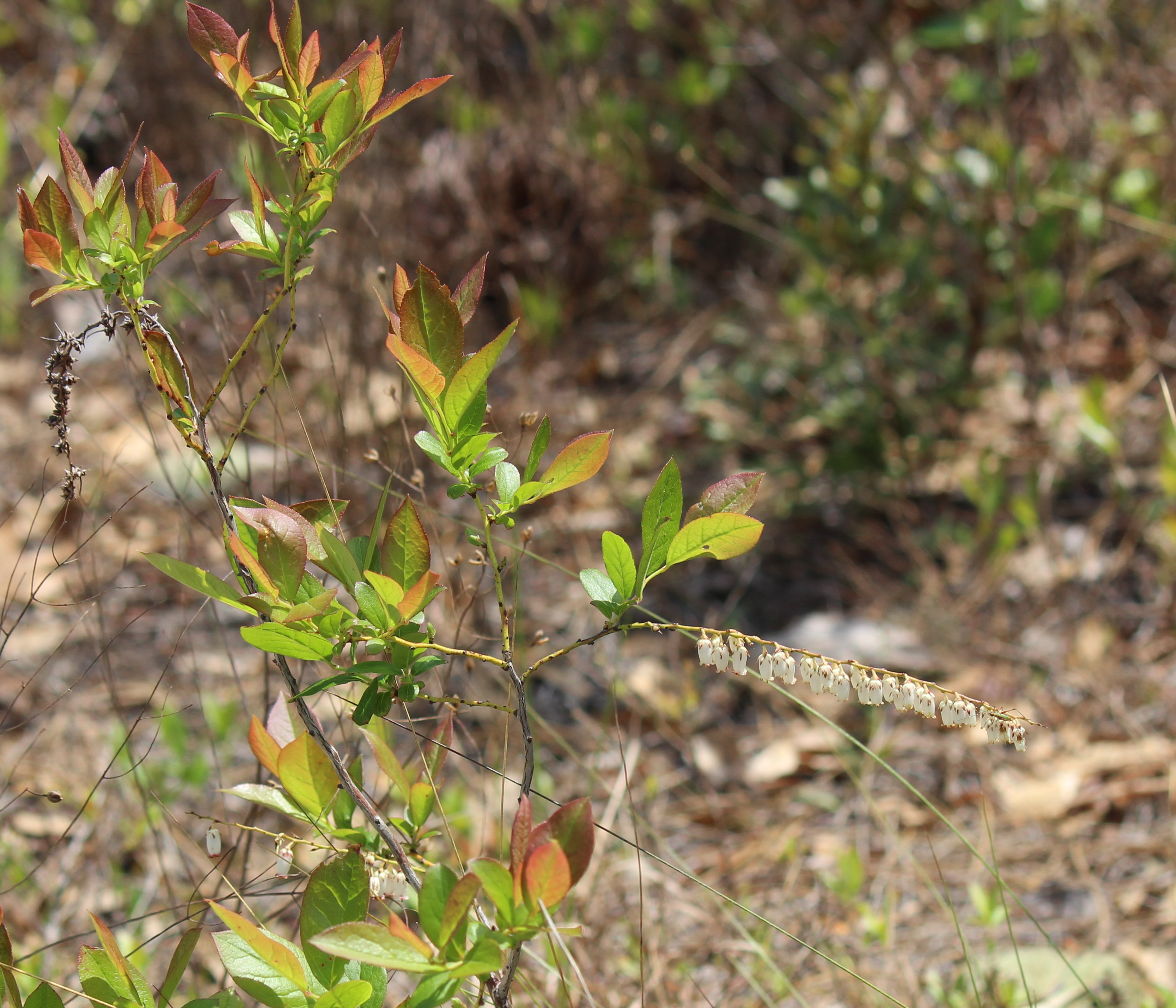
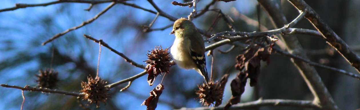
Although it is not an undisturbed landscape, it still has some awesome plant and bird diversity. Lots of Longleaf Pine, Pinus palustris, Titi, Cyrilla racemiflora, Inkberry, Ilex glabra, Fetterbush, Lyonia and Eubotrys spp., Blueberry, Vaccinium and Huckleberry, Gaylussacia species. We’ve heard (and tax records seem to indicate…) that the area we were wandering will be a future addition to the park. Fingers crossed for trails versus sports fields!
More park space will be especially awesome if they can manage to keep the plant diversity. At the southern end, however, a silt fence, a mesh/seed-stabilized swale, and the loud grumblings of heavy equipment foretell the coming of…drum roll, more patio homes!!
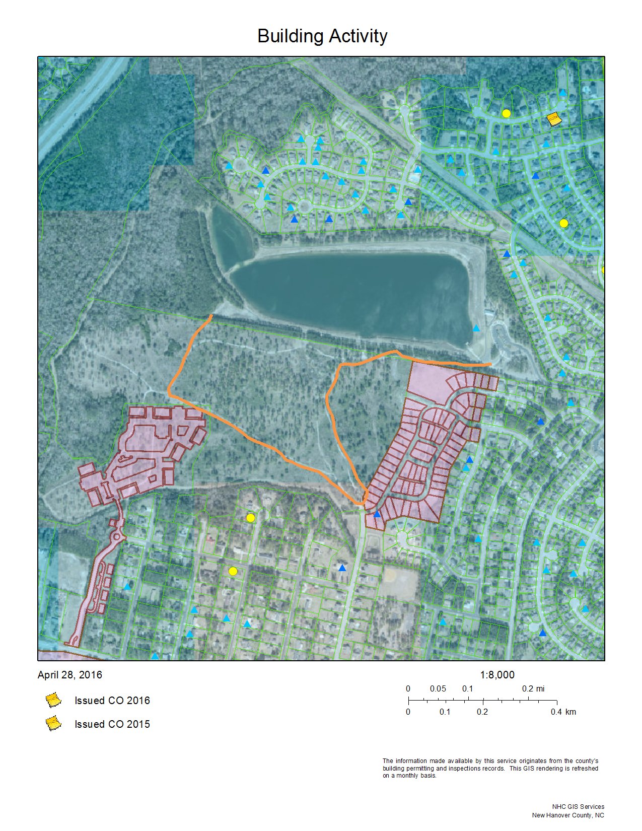
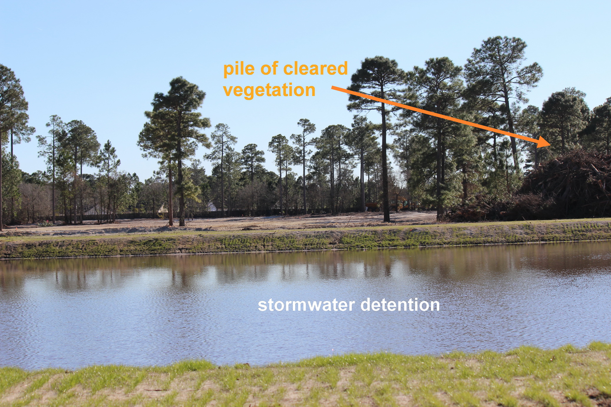
As a new development adjacent to a ‘nature’ park, standards for design and site preparation should be better tuned to conservation. Ding dang it. No vegetation, pure de-nudement. Denouement…?!
